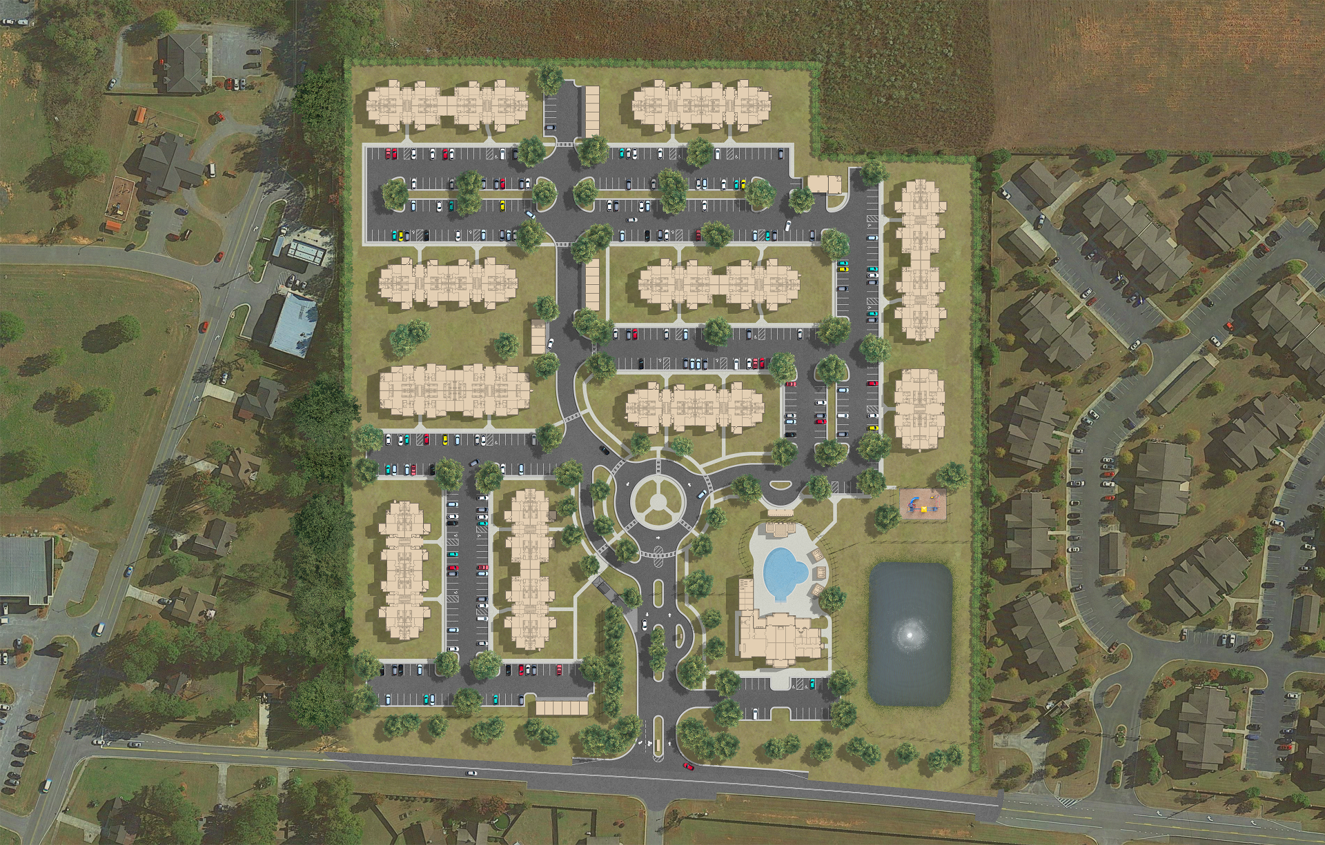
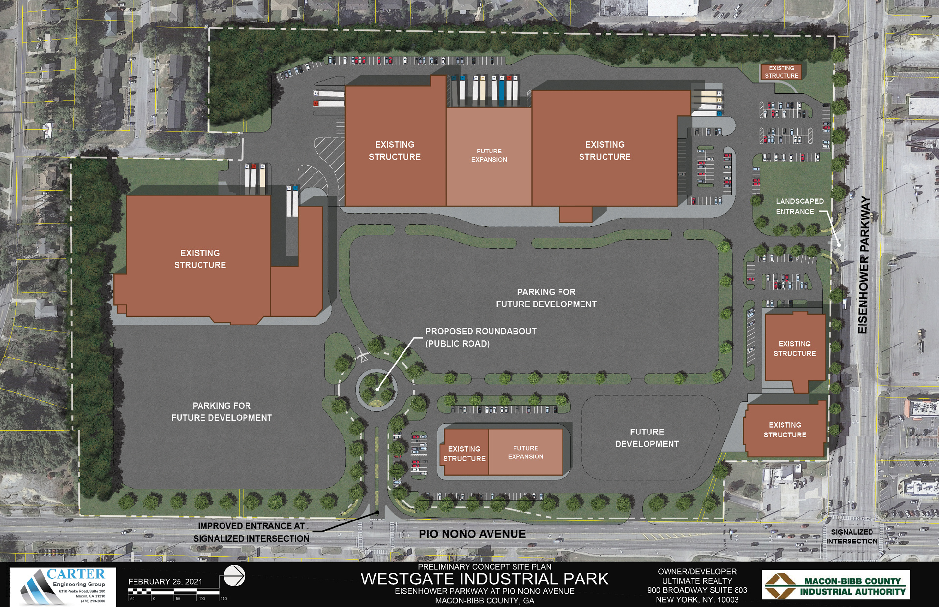
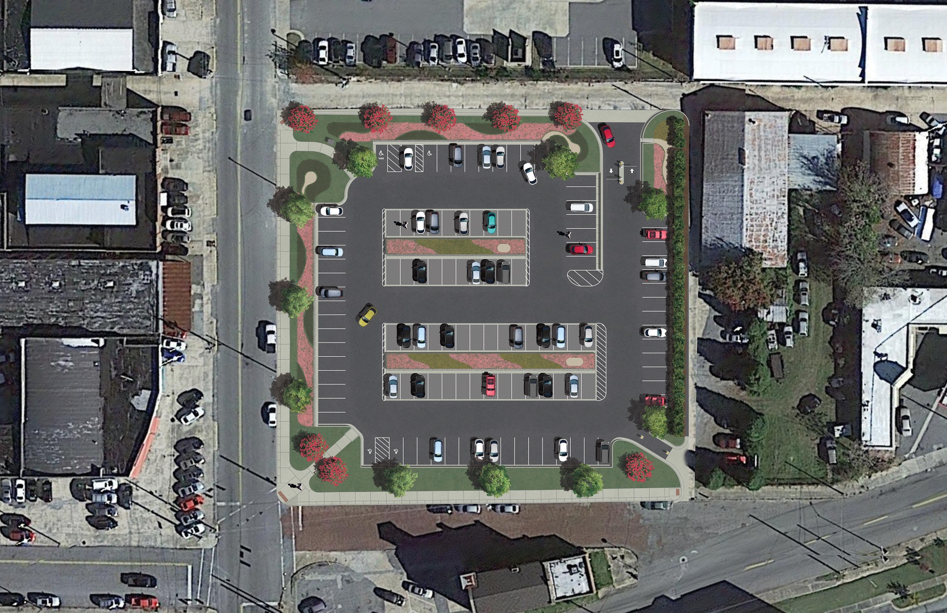
Objective
To illustrate assorted pre-produced aerial view landscape plans.Background
As a temporary freelance work project, I was employed by Carter Engineering Group to add color and props to existing AutoCAD digital plans. These would be presented to clients as visualization for designs that were in progress.
To start, I was given AutoCAD DWG files. I seperated and exported drawing layers and imported them to Photoshop.
I used various 2D object and texture assets, purchased or made by myself, to color and populate the render.
The illustration's color levels were tailored to the client's feedback and title blocks added

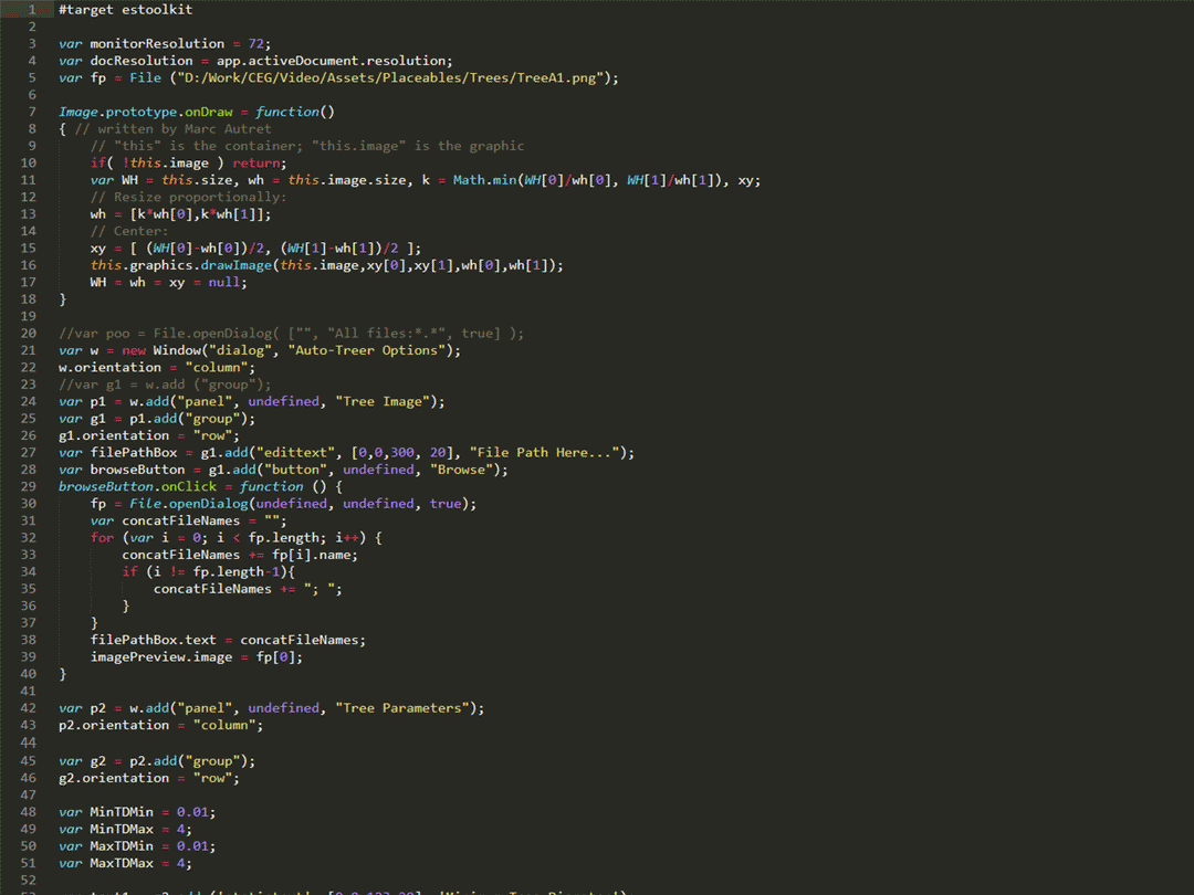
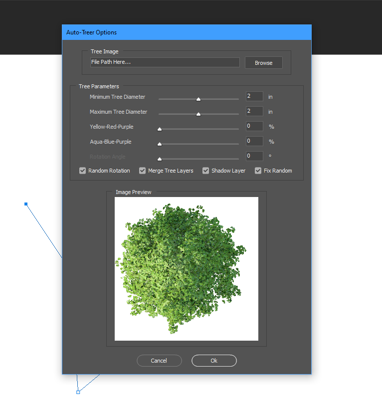
Automation
In order to simplify my workflow, I created two scripts in ExtendScript: One that places tree textures on points along a path, and another creates a random field of points. Both are customizable (tree texture, size, hue, rotation, point concentration, etc.).